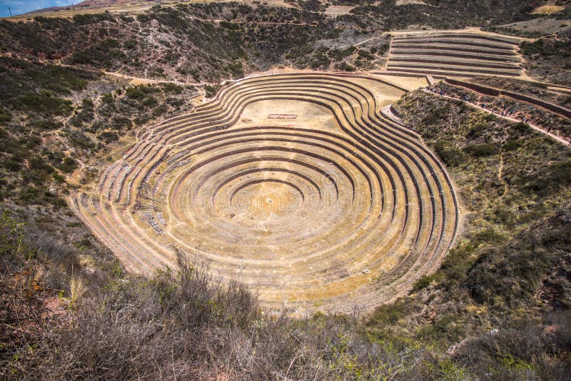
Moray[1][2] Quechua: Muray[3] is an archaeological site in Peru approximately 50 kilometres 31 mi northwest of Cuzco on a high plateau at about 3,500 metres 11,500 ft and just west of the village of Maras. The site contains unusual Inca ruins, mostly consisting of several terraced circular depressions, the largest of which is approximately 30 m 98 ft deep. As with many other Inca sites, it also has an irrigation system. The purpose of these depressions is uncertain, but their depth, design, and orientation with respect to wind and sun creates a temperature difference of as much as 15 ðC 27 ðF between the top and the bottom. It is possible that this large temperature difference was used by the Inca to study the effects of different climatic conditions on crops. Speculation about the site has led to discussion about Moray as an Inca agricultural experiment station
圖片編號:
107394101
拍攝者:
Phsimonepitrolo
點數下載
| 授權類型 | 尺寸 | 像素 | 格式 | 點數 | |
|---|---|---|---|---|---|
| 標準授權 | XS | 480 x 254 | JPG | 13 | |
| 標準授權 | S | 800 x 424 | JPG | 15 | |
| 標準授權 | M | 2378 x 1261 | JPG | 18 | |
| 標準授權 | L | 3071 x 1628 | JPG | 20 | |
| 標準授權 | XL | 3884 x 2059 | JPG | 22 | |
| 標準授權 | MAX | 8977 x 4759 | JPG | 23 | |
| 標準授權 | TIFF | 12695 x 6730 | TIF | 39 | |
| 進階授權 | WEL | 8977 x 4759 | JPG | 88 | |
| 進階授權 | PEL | 8977 x 4759 | JPG | 88 | |
| 進階授權 | UEL | 8977 x 4759 | JPG | 88 |
XS
S
M
L
XL
MAX
TIFF
WEL
PEL
UEL
| 標準授權 | 480 x 254 px | JPG | 13 點 |
| 標準授權 | 800 x 424 px | JPG | 15 點 |
| 標準授權 | 2378 x 1261 px | JPG | 18 點 |
| 標準授權 | 3071 x 1628 px | JPG | 20 點 |
| 標準授權 | 3884 x 2059 px | JPG | 22 點 |
| 標準授權 | 8977 x 4759 px | JPG | 23 點 |
| 標準授權 | 12695 x 6730 px | TIF | 39 點 |
| 進階授權 | 8977 x 4759 px | JPG | 88 點 |
| 進階授權 | 8977 x 4759 px | JPG | 88 點 |
| 進階授權 | 8977 x 4759 px | JPG | 88 點 |


 +886-2-8978-1616
 +886-2-2078-5115


