


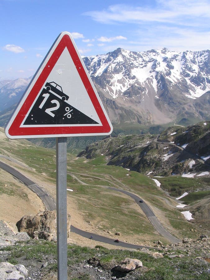
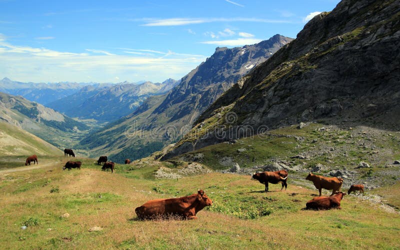
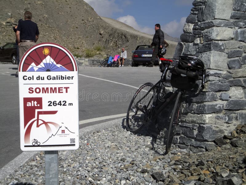
Col du Galibier (el. 2645 m.) is a mountain pass in the southern region of the French Dauphiné Alps near Grenoble. It is often the highest point of the Tour de France. It connects Saint-Michel-de-Maurienne and Briançon via the col du Télégraphe and the Col du Lautaret. The pass is closed during the winter. It is located between the massif d'Arvan-Villards and the massif des Cerces, taking its name from the secondary chain of mountains known as the Galibier. Before 1976, the tunnel was the only point of passage at the top, at an altitude of 2556 m. The tunnel was closed for restoration until 2002, and a new road was constructed over the summit. The re-opened tunnel is a single lane controlled by traffic lights which, at 2400 m., must be amongst the highest in Europe.
圖片編號:
11921475
拍攝者:
Disev
點數下載
| 授權類型 | 尺寸 | 像素 | 格式 | 點數 | |
|---|---|---|---|---|---|
| 標準授權 | XS | 480 x 360 | JPG | 13 | |
| 標準授權 | S | 800 x 600 | JPG | 15 | |
| 標準授權 | M | 2000 x 1500 | JPG | 18 | |
| 標準授權 | L | 2581 x 1936 | JPG | 20 | |
| 標準授權 | XL | 3265 x 2449 | JPG | 22 | |
| 標準授權 | MAX | 4000 x 3000 | JPG | 23 | |
| 標準授權 | TIFF | 5657 x 4243 | TIF | 39 | |
| 進階授權 | WEL | 4000 x 3000 | JPG | 88 | |
| 進階授權 | PEL | 4000 x 3000 | JPG | 88 | |
| 進階授權 | UEL | 4000 x 3000 | JPG | 88 |
XS
S
M
L
XL
MAX
TIFF
WEL
PEL
UEL
| 標準授權 | 480 x 360 px | JPG | 13 點 |
| 標準授權 | 800 x 600 px | JPG | 15 點 |
| 標準授權 | 2000 x 1500 px | JPG | 18 點 |
| 標準授權 | 2581 x 1936 px | JPG | 20 點 |
| 標準授權 | 3265 x 2449 px | JPG | 22 點 |
| 標準授權 | 4000 x 3000 px | JPG | 23 點 |
| 標準授權 | 5657 x 4243 px | TIF | 39 點 |
| 進階授權 | 4000 x 3000 px | JPG | 88 點 |
| 進階授權 | 4000 x 3000 px | JPG | 88 點 |
| 進階授權 | 4000 x 3000 px | JPG | 88 點 |


 +886-2-8978-1616
 +886-2-2078-5115


