


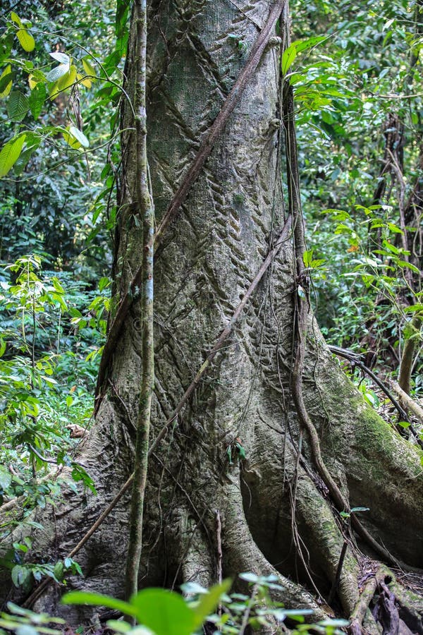
This picture is taken in Sarawak. The Gunung Mulu National Park is a national park in Miri Division, Sarawak, Malaysia, is a UNESCO World Heritage Site that encompasses caves and karst formations in a mountainous equatorial rainforest setting. The park is famous for its caves and the expeditions that have been mounted to explore them and their surrounding rainforest, most notably the Royal Geographical Society Expedition of 1977ââ¬â1978, which saw over 100 scientists in the field for 15 months. This initiated a series of over 20 expeditions now drawn together as the Mulu Caves Project
圖片編號:
124606277
拍攝者:
Nhungbuocchan
點數下載
| 授權類型 | 尺寸 | 像素 | 格式 | 點數 | |
|---|---|---|---|---|---|
| 標準授權 | XS | 320 x 480 | JPG | 13 | |
| 標準授權 | S | 533 x 800 | JPG | 15 | |
| 標準授權 | M | 1414 x 2121 | JPG | 18 | |
| 標準授權 | L | 1825 x 2738 | JPG | 20 | |
| 標準授權 | XL | 2309 x 3464 | JPG | 22 | |
| 標準授權 | MAX | 3744 x 5616 | JPG | 23 | |
| 標準授權 | TIFF | 5295 x 7942 | TIF | 39 | |
| 進階授權 | WEL | 3744 x 5616 | JPG | 88 | |
| 進階授權 | PEL | 3744 x 5616 | JPG | 88 | |
| 進階授權 | UEL | 3744 x 5616 | JPG | 88 |
XS
S
M
L
XL
MAX
TIFF
WEL
PEL
UEL
| 標準授權 | 320 x 480 px | JPG | 13 點 |
| 標準授權 | 533 x 800 px | JPG | 15 點 |
| 標準授權 | 1414 x 2121 px | JPG | 18 點 |
| 標準授權 | 1825 x 2738 px | JPG | 20 點 |
| 標準授權 | 2309 x 3464 px | JPG | 22 點 |
| 標準授權 | 3744 x 5616 px | JPG | 23 點 |
| 標準授權 | 5295 x 7942 px | TIF | 39 點 |
| 進階授權 | 3744 x 5616 px | JPG | 88 點 |
| 進階授權 | 3744 x 5616 px | JPG | 88 點 |
| 進階授權 | 3744 x 5616 px | JPG | 88 點 |


 +886-2-8978-1616
 +886-2-2078-5115


