


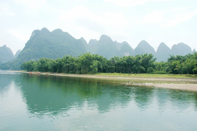
the lijiang river, a tributary of the upper reaches of the guijiang river, is located in the northeast of guangxi zhuang autonomous region. in the traditional sense, the starting point of the lijiang river is the mao-ershan mountain, the source of the guijiang river, and the modern hydrological definition is lingqu estuary in the town of solujiang, xingan county, and the end point is the sanjiangkou in pingle county. The upper reaches of the lijiang river is the great dissolved river, and the lower reaches is the traditional name of the guijiang river. the mouth of lingqu river is the dividing point between the lijiang river and the lijiang river, and the lipu river and the gongcheng river are the dividing points of the lijiang river and the guijiang river. the length of the lijiang river is 164 km. the riverbed along the river is mostly composed of water quality pebbles, small amount of mud and sand, clear water quality, and mostly karst landforms on both sides of the river. rich in tourist resources, the famous landscape of guilin lies on the lijiang river.
圖片編號:
126018111
拍攝者:
Yanghaozhe16201041
點數下載
| 授權類型 | 尺寸 | 像素 | 格式 | 點數 | |
|---|---|---|---|---|---|
| 標準授權 | XS | 480 x 360 | JPG | 13 | |
| 標準授權 | S | 800 x 600 | JPG | 15 | |
| 標準授權 | M | 2000 x 1500 | JPG | 18 | |
| 標準授權 | L | 2592 x 1944 | JPG | 20 | |
| 標準授權 | XL | 3265 x 2449 | JPG | 22 | |
| 標準授權 | MAX | 4000 x 3000 | JPG | 23 | |
| 標準授權 | TIFF | 3666 x 2749 | TIF | 39 | |
| 進階授權 | WEL | 4000 x 3000 | JPG | 88 | |
| 進階授權 | PEL | 4000 x 3000 | JPG | 88 | |
| 進階授權 | UEL | 4000 x 3000 | JPG | 88 |
XS
S
M
L
XL
MAX
TIFF
WEL
PEL
UEL
| 標準授權 | 480 x 360 px | JPG | 13 點 |
| 標準授權 | 800 x 600 px | JPG | 15 點 |
| 標準授權 | 2000 x 1500 px | JPG | 18 點 |
| 標準授權 | 2592 x 1944 px | JPG | 20 點 |
| 標準授權 | 3265 x 2449 px | JPG | 22 點 |
| 標準授權 | 4000 x 3000 px | JPG | 23 點 |
| 標準授權 | 3666 x 2749 px | TIF | 39 點 |
| 進階授權 | 4000 x 3000 px | JPG | 88 點 |
| 進階授權 | 4000 x 3000 px | JPG | 88 點 |
| 進階授權 | 4000 x 3000 px | JPG | 88 點 |


 +886-2-8978-1616
 +886-2-2078-5115


