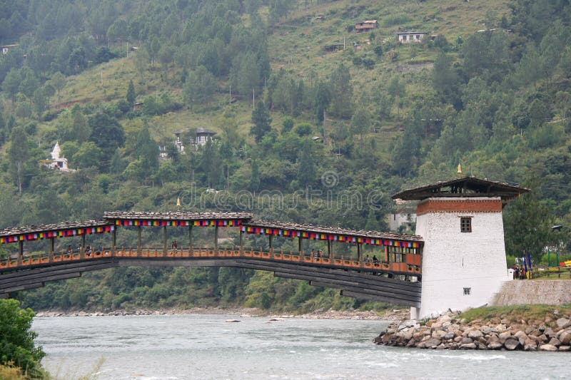
Punakha is the administrative centre of Bhutan. Punakha was the capital of Bhutan and the seat of government until 1955, when the capital was moved to Thimphu. It is located at an elevation of 1,200 metres above sea level and rice is grown as the main crop along the river valleys of two main rivers of Bhutan, the Pho Chu and Mo Chu. This picture captures the Pho Chu river side.
圖片編號:
126242470
拍攝者:
Fatema7864
點數下載
| 授權類型 | 尺寸 | 像素 | 格式 | 點數 | |
|---|---|---|---|---|---|
| 標準授權 | XS | 480 x 360 | JPG | 13 | |
| 標準授權 | S | 800 x 600 | JPG | 15 | |
| 標準授權 | M | 2000 x 1500 | JPG | 18 | |
| 標準授權 | L | 2581 x 1936 | JPG | 20 | |
| 標準授權 | XL | 3265 x 2449 | JPG | 22 | |
| 標準授權 | MAX | 4896 x 3672 | JPG | 23 | |
| 標準授權 | TIFF | 6924 x 5193 | TIF | 39 | |
| 進階授權 | WEL | 4896 x 3672 | JPG | 88 | |
| 進階授權 | PEL | 4896 x 3672 | JPG | 88 | |
| 進階授權 | UEL | 4896 x 3672 | JPG | 88 |
XS
S
M
L
XL
MAX
TIFF
WEL
PEL
UEL
| 標準授權 | 480 x 360 px | JPG | 13 點 |
| 標準授權 | 800 x 600 px | JPG | 15 點 |
| 標準授權 | 2000 x 1500 px | JPG | 18 點 |
| 標準授權 | 2581 x 1936 px | JPG | 20 點 |
| 標準授權 | 3265 x 2449 px | JPG | 22 點 |
| 標準授權 | 4896 x 3672 px | JPG | 23 點 |
| 標準授權 | 6924 x 5193 px | TIF | 39 點 |
| 進階授權 | 4896 x 3672 px | JPG | 88 點 |
| 進階授權 | 4896 x 3672 px | JPG | 88 點 |
| 進階授權 | 4896 x 3672 px | JPG | 88 點 |


 +886-2-8978-1616
 +886-2-2078-5115


