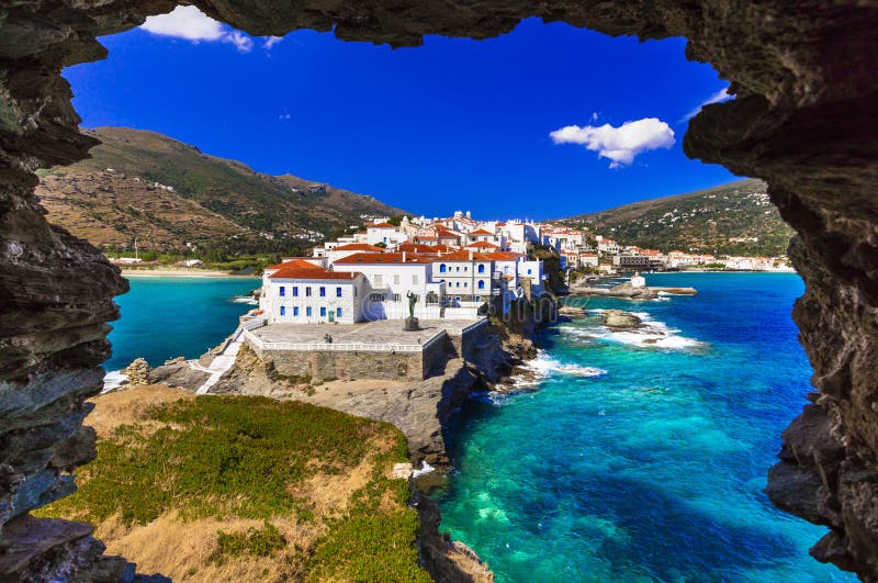
Andros Greek: Ãâ ýôÃÂÿÃâ, pronounced [ÃËanðros] is the northernmost island of the Greek Cyclades archipelago, about 10 km 6 mi southeast of Euboea, and about 3 km 2 mi north of Tinos. It is nearly 40 km 25 mi long, and its greatest breadth is 16 km 10 mi. It is for the most part mountainous, with many fruitful and well-watered valleys.[1] The municipality, which includes the island Andros and several small, uninhabited islands, has an area of 380 km2 146.719 sq mi.[2] The largest towns are Andros town, Gavrio, Batsi, and Ormos Korthiou.nThe largest town and capital of the island is Chora or Naxos City, with 6,533 inhabitants 2001 census. The main villages are Filoti, Apiranthos, Vivlos, Agios Arsenios, Koronos and Glinado.
圖片編號:
131918092
拍攝者:
Mihai23378
點數下載
| 授權類型 | 尺寸 | 像素 | 格式 | 點數 | |
|---|---|---|---|---|---|
| 標準授權 | XS | 480 x 172 | JPG | 13 | |
| 標準授權 | S | 800 x 287 | JPG | 15 | |
| 標準授權 | M | 2893 x 1036 | JPG | 18 | |
| 標準授權 | L | 4500 x 1613 | JPG | 20 | |
| 標準授權 | XL | 4724 x 1693 | JPG | 22 | |
| 標準授權 | MAX | 5786 x 2073 | JPG | 23 | |
| 標準授權 | TIFF | 6364 x 2281 | TIF | 39 | |
| 進階授權 | WEL | 5786 x 2073 | JPG | 88 | |
| 進階授權 | PEL | 5786 x 2073 | JPG | 88 | |
| 進階授權 | UEL | 5786 x 2073 | JPG | 88 |
XS
S
M
L
XL
MAX
TIFF
WEL
PEL
UEL
| 標準授權 | 480 x 172 px | JPG | 13 點 |
| 標準授權 | 800 x 287 px | JPG | 15 點 |
| 標準授權 | 2893 x 1036 px | JPG | 18 點 |
| 標準授權 | 4500 x 1613 px | JPG | 20 點 |
| 標準授權 | 4724 x 1693 px | JPG | 22 點 |
| 標準授權 | 5786 x 2073 px | JPG | 23 點 |
| 標準授權 | 6364 x 2281 px | TIF | 39 點 |
| 進階授權 | 5786 x 2073 px | JPG | 88 點 |
| 進階授權 | 5786 x 2073 px | JPG | 88 點 |
| 進階授權 | 5786 x 2073 px | JPG | 88 點 |


 +886-2-8978-1616
 +886-2-2078-5115


