


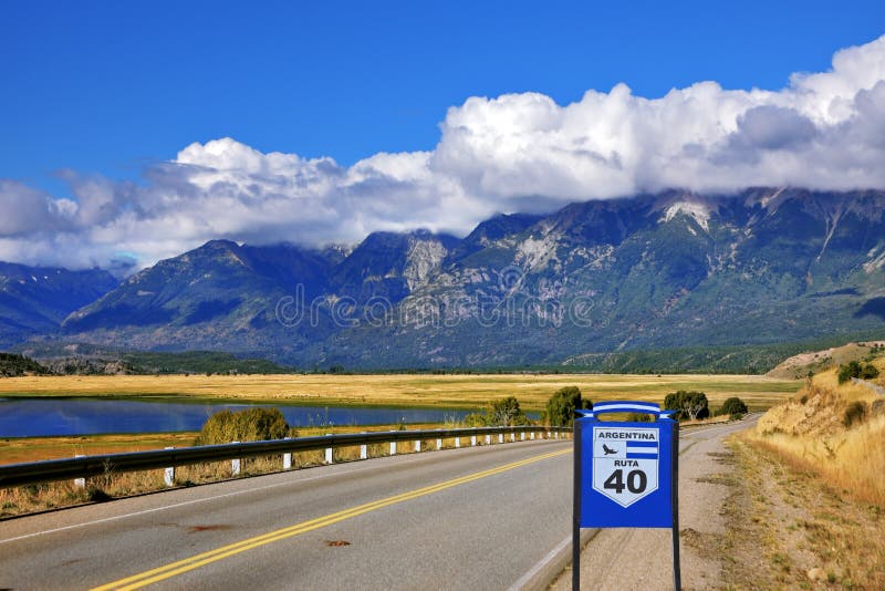
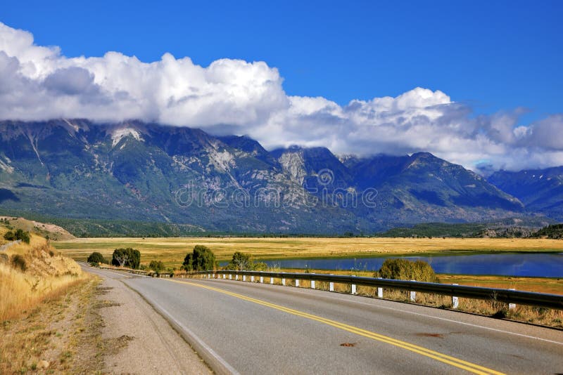
National Route 40, also known as RN40 or `Ruta 40`, is a route in western Argentina, stretching from Punta Loyola near Rio Gallegos in Santa Cruz Province in the south to La Quiaca in Jujuy Province in the north. The route parallels the Andes mountains. The southern part of the route, by now largely paved, has become a well-known adventure tourism journey, and there are plans to pave the whole road. RN40 is the longest route in Argentina and one of the longest in the world alongside such routes as U.S. Route 66, Canada`s Trans-Canada Highway, and Australia`s Stuart Highway, more than 5,000 kilometres 3,100 mi long. At its traditional southern end near the city of RÃÂo Gallegos, it starts at sea level. It then crosses 20 national parks, 18 major rivers, and 27 passes in the Andes. Route 40`s highest point is 5,000 m 16,404 ft in Abra del Acay in Salta Province. The road crosses the provinces of Santa Cruz, Chubut, RÃÂo Negro, Neuquen, Mendoza, San Juan, La Rioja, Catamarca, Tucumán, Salta, and Jujuy.
圖片編號:
140478386
拍攝者:
Cegocentrico
點數下載
| 授權類型 | 尺寸 | 像素 | 格式 | 點數 | |
|---|---|---|---|---|---|
| 標準授權 | XS | 360 x 480 | JPG | 13 | |
| 標準授權 | S | 600 x 800 | JPG | 15 | |
| 標準授權 | M | 1500 x 2000 | JPG | 18 | |
| 標準授權 | L | 1936 x 2581 | JPG | 20 | |
| 標準授權 | XL | 2449 x 3265 | JPG | 22 | |
| 標準授權 | MAX | 3864 x 5152 | JPG | 23 | |
| 標準授權 | TIFF | 5465 x 7286 | TIF | 39 | |
| 進階授權 | WEL | 3864 x 5152 | JPG | 88 | |
| 進階授權 | PEL | 3864 x 5152 | JPG | 88 | |
| 進階授權 | UEL | 3864 x 5152 | JPG | 88 |
XS
S
M
L
XL
MAX
TIFF
WEL
PEL
UEL
| 標準授權 | 360 x 480 px | JPG | 13 點 |
| 標準授權 | 600 x 800 px | JPG | 15 點 |
| 標準授權 | 1500 x 2000 px | JPG | 18 點 |
| 標準授權 | 1936 x 2581 px | JPG | 20 點 |
| 標準授權 | 2449 x 3265 px | JPG | 22 點 |
| 標準授權 | 3864 x 5152 px | JPG | 23 點 |
| 標準授權 | 5465 x 7286 px | TIF | 39 點 |
| 進階授權 | 3864 x 5152 px | JPG | 88 點 |
| 進階授權 | 3864 x 5152 px | JPG | 88 點 |
| 進階授權 | 3864 x 5152 px | JPG | 88 點 |


 +886-2-8978-1616
 +886-2-2078-5115


