


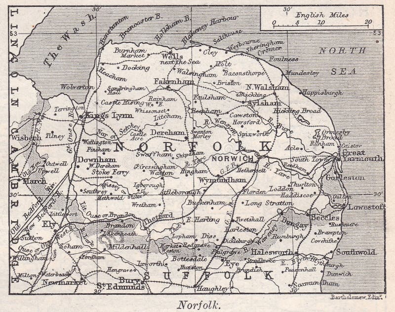
The Harmsworth Encyclopaedia 1930s / 1940s - Social history. Vintage map of Norfolk 1900s. Norfolk is a county in East Anglia in England. It borders Lincolnshire to the northwest, Cambridgeshire to the west and southwest, and Suffolk to the south. Its northern and eastern boundaries are the North Sea and to the north-west, The Wash. The county town is Norwich.
圖片編號:
176993088
拍攝者:
Mjb6661
點數下載
| 授權類型 | 尺寸 | 像素 | 格式 | 點數 | |
|---|---|---|---|---|---|
| 標準授權 | XS | 480 x 380 | JPG | 13 | |
| 標準授權 | S | 800 x 633 | JPG | 15 | |
| 標準授權 | M | 2080 x 1645 | JPG | 18 | |
| 標準授權 | L | 2514 x 1988 | JPG | 20 | |
| 標準授權 | XL | 3180 x 2515 | JPG | 22 | |
| 標準授權 | MAX | 3895 x 3080 | JPG | 23 | |
| 標準授權 | TIFF | 2942 x 2326 | TIF | 39 | |
| 進階授權 | UEL | 3895 x 3080 | JPG | 88 |
XS
S
M
L
XL
MAX
TIFF
UEL
| 標準授權 | 480 x 380 px | JPG | 13 點 |
| 標準授權 | 800 x 633 px | JPG | 15 點 |
| 標準授權 | 2080 x 1645 px | JPG | 18 點 |
| 標準授權 | 2514 x 1988 px | JPG | 20 點 |
| 標準授權 | 3180 x 2515 px | JPG | 22 點 |
| 標準授權 | 3895 x 3080 px | JPG | 23 點 |
| 標準授權 | 2942 x 2326 px | TIF | 39 點 |
| 進階授權 | 3895 x 3080 px | JPG | 88 點 |


 +886-2-8978-1616
 +886-2-2078-5115


