


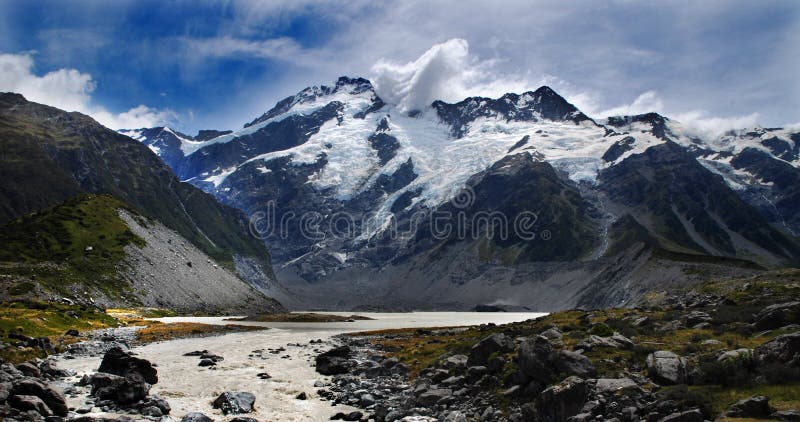
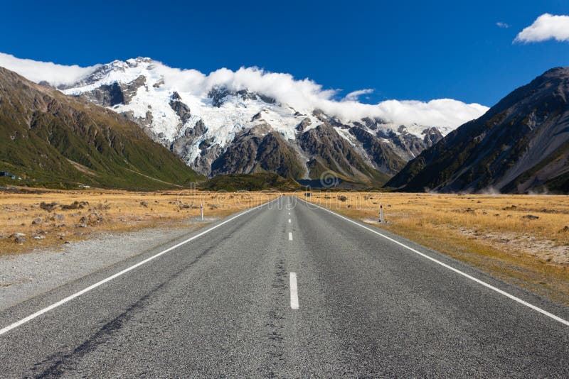
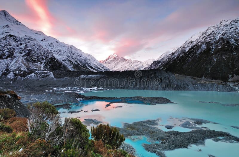
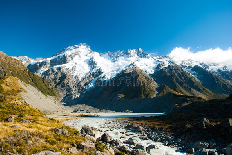
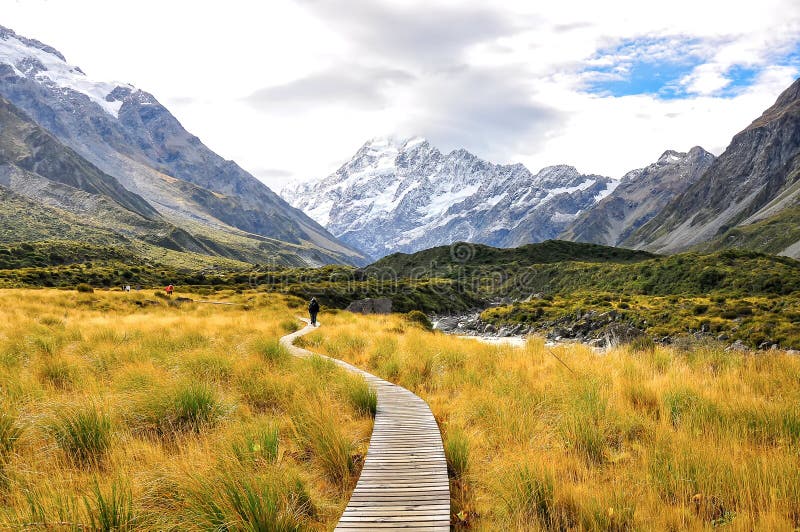
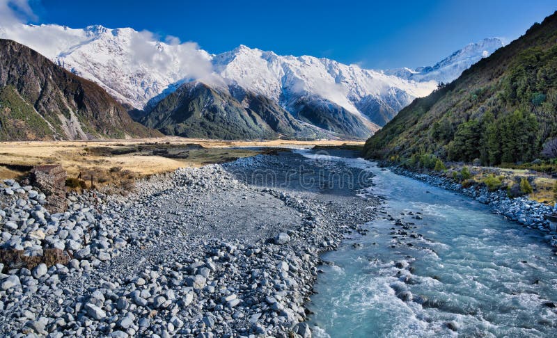
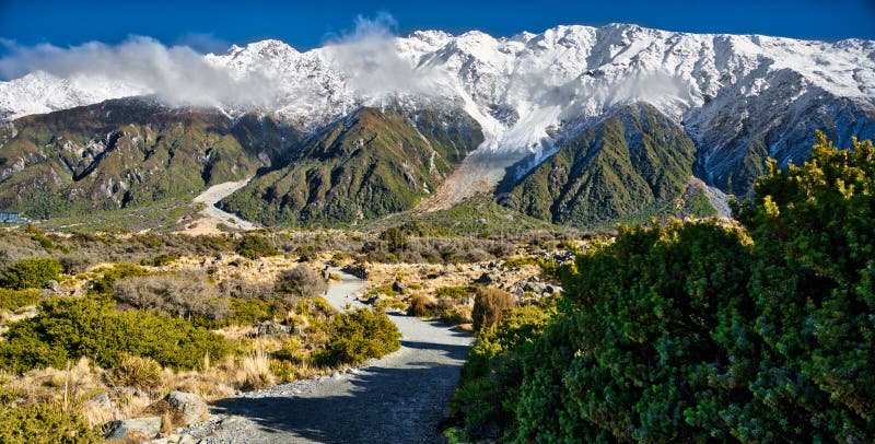
Aoraki Mount Cook National Park is in the South Island of New Zealand, near the town of Twizel. Aoraki / Mount Cook, New Zealand`s highest mountain, and Aoraki/Mount Cook Village lie within the park. The area was gazetted as a national park in October 1953 and consists of reserves that were established as early as 1887 to protect the area`s significant vegetation and landscape.nnEven though most of the park is alpine terrain, it is easily accessible. The only road access into Aoraki/Mount Cook National Park is via State Highway 80, which starts near Twizel, at 65 kilometres 40 mi distance the closest town to the park, and leads directly to Mount Cook Village, where the road ends.[2] The village is situated within the park, however, it consists only of a hotel and motels, as well as housing and amenities for the staff of the hotel and motels and other support personnel.
圖片編號:
192396952
拍攝者:
Mauriehill
點數下載
| 授權類型 | 尺寸 | 像素 | 格式 | 點數 | |
|---|---|---|---|---|---|
| 標準授權 | XS | 480 x 284 | JPG | 13 | |
| 標準授權 | S | 800 x 473 | JPG | 15 | |
| 標準授權 | M | 2253 x 1331 | JPG | 18 | |
| 標準授權 | L | 2909 x 1718 | JPG | 20 | |
| 標準授權 | XL | 3679 x 2174 | JPG | 22 | |
| 標準授權 | MAX | 8178 x 4832 | JPG | 23 | |
| 標準授權 | TIFF | 11565 x 6833 | TIF | 39 | |
| 進階授權 | WEL | 8178 x 4832 | JPG | 88 | |
| 進階授權 | PEL | 8178 x 4832 | JPG | 88 | |
| 進階授權 | UEL | 8178 x 4832 | JPG | 88 |
XS
S
M
L
XL
MAX
TIFF
WEL
PEL
UEL
| 標準授權 | 480 x 284 px | JPG | 13 點 |
| 標準授權 | 800 x 473 px | JPG | 15 點 |
| 標準授權 | 2253 x 1331 px | JPG | 18 點 |
| 標準授權 | 2909 x 1718 px | JPG | 20 點 |
| 標準授權 | 3679 x 2174 px | JPG | 22 點 |
| 標準授權 | 8178 x 4832 px | JPG | 23 點 |
| 標準授權 | 11565 x 6833 px | TIF | 39 點 |
| 進階授權 | 8178 x 4832 px | JPG | 88 點 |
| 進階授權 | 8178 x 4832 px | JPG | 88 點 |
| 進階授權 | 8178 x 4832 px | JPG | 88 點 |


 +886-2-8978-1616
 +886-2-2078-5115


