


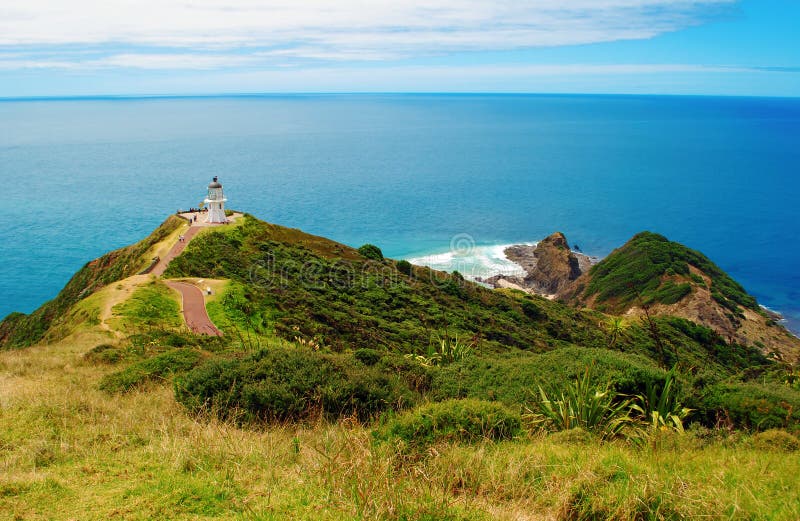
Cape Reinga Te Rerenga Wairua is the north western most tip of the Aupouri Peninsula, at the northern end of the North Island of New Zealand. Cape Reinga is more than 100 km north of the nearest small town of Kaitaia. State Highway 1 extends all the way to the cape, but until 2010 was unsealed gravel road for the last 19 km.[2] Suitable vehicles can also travel much of the way via Ninety Mile Beach and Kauaeparaoa Stream Te Paki Stream stream bed.
圖片編號:
206672394
拍攝者:
Steve1reid
點數下載
| 授權類型 | 尺寸 | 像素 | 格式 | 點數 | |
|---|---|---|---|---|---|
| 標準授權 | XS | 480 x 360 | JPG | 13 | |
| 標準授權 | S | 800 x 600 | JPG | 15 | |
| 標準授權 | M | 2000 x 1500 | JPG | 18 | |
| 標準授權 | L | 2581 x 1936 | JPG | 20 | |
| 標準授權 | XL | 3265 x 2449 | JPG | 22 | |
| 標準授權 | MAX | 4000 x 3000 | JPG | 23 | |
| 標準授權 | TIFF | 5657 x 4243 | TIF | 39 | |
| 進階授權 | WEL | 4000 x 3000 | JPG | 88 | |
| 進階授權 | PEL | 4000 x 3000 | JPG | 88 | |
| 進階授權 | UEL | 4000 x 3000 | JPG | 88 |
XS
S
M
L
XL
MAX
TIFF
WEL
PEL
UEL
| 標準授權 | 480 x 360 px | JPG | 13 點 |
| 標準授權 | 800 x 600 px | JPG | 15 點 |
| 標準授權 | 2000 x 1500 px | JPG | 18 點 |
| 標準授權 | 2581 x 1936 px | JPG | 20 點 |
| 標準授權 | 3265 x 2449 px | JPG | 22 點 |
| 標準授權 | 4000 x 3000 px | JPG | 23 點 |
| 標準授權 | 5657 x 4243 px | TIF | 39 點 |
| 進階授權 | 4000 x 3000 px | JPG | 88 點 |
| 進階授權 | 4000 x 3000 px | JPG | 88 點 |
| 進階授權 | 4000 x 3000 px | JPG | 88 點 |


 +886-2-8978-1616
 +886-2-2078-5115


