


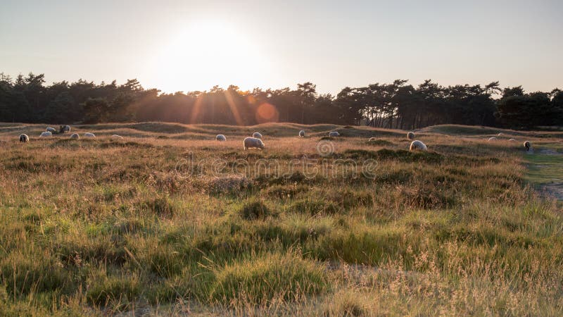
The area between Driebergen and Amersfoort was already a forest area before the Middle Ages. Barley, rye, buckwheat and wheat were grown on the scattered fields. Due to increasing reclamation, the forests were cut down and the natural wealth of the soil was depleted. Due to increased logging and overgrazing by sheep, the forest area slowly turned into an open plain with heaths and sand drifts. Between 1870 and 1890 coniferous forests were planted on a large scale for the production of wood.
圖片編號:
221004323
拍攝者:
Tonsnijders
點數下載
| 授權類型 | 尺寸 | 像素 | 格式 | 點數 | |
|---|---|---|---|---|---|
| 標準授權 | XS | 480 x 320 | JPG | 13 | |
| 標準授權 | S | 800 x 533 | JPG | 15 | |
| 標準授權 | M | 2121 x 1414 | JPG | 18 | |
| 標準授權 | L | 2738 x 1825 | JPG | 20 | |
| 標準授權 | XL | 3464 x 2309 | JPG | 22 | |
| 標準授權 | MAX | 6000 x 4000 | JPG | 23 | |
| 標準授權 | TIFF | 8485 x 5657 | TIF | 39 | |
| 進階授權 | WEL | 6000 x 4000 | JPG | 88 | |
| 進階授權 | PEL | 6000 x 4000 | JPG | 88 | |
| 進階授權 | UEL | 6000 x 4000 | JPG | 88 |
XS
S
M
L
XL
MAX
TIFF
WEL
PEL
UEL
| 標準授權 | 480 x 320 px | JPG | 13 點 |
| 標準授權 | 800 x 533 px | JPG | 15 點 |
| 標準授權 | 2121 x 1414 px | JPG | 18 點 |
| 標準授權 | 2738 x 1825 px | JPG | 20 點 |
| 標準授權 | 3464 x 2309 px | JPG | 22 點 |
| 標準授權 | 6000 x 4000 px | JPG | 23 點 |
| 標準授權 | 8485 x 5657 px | TIF | 39 點 |
| 進階授權 | 6000 x 4000 px | JPG | 88 點 |
| 進階授權 | 6000 x 4000 px | JPG | 88 點 |
| 進階授權 | 6000 x 4000 px | JPG | 88 點 |


 +886-2-8978-1616
 +886-2-2078-5115


