


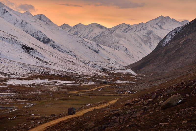
Babusar Pass or Babusar Top (elevation 4,173 metres or 13,691 feet) is a mountain pass in Pakistan at the north of the 150 km (93 miles) long Kaghan Valley, connecting it via the Thak Nala with Chilas on the Karakoram Highway (KKH). It is the highest point in the Babusar Valley that can be easily accessed by cars. The Babusar Pass connects Khyber Pakhtunkhwa with Gilgit Baltistan. It is one of the most dangerous routes in Gilgit-Baltistan. Every year many deaths happen here due to the mountainous slopes, which are among the most dangerous in the world. The most common reason for death is the brake failure of cars due to inexperience. Babusar Top was originally known as Babur Top, originating from the fact that the Mughal emperor Babur used to pass through this area in the early 16th century. Nowadays however, it is commonly referred to as Babusar Top.
圖片編號:
229934562
拍攝者:
Nasirmunir926
點數下載
| 授權類型 | 尺寸 | 像素 | 格式 | 點數 | |
|---|---|---|---|---|---|
| 標準授權 | XS | 480 x 360 | JPG | 13 | |
| 標準授權 | S | 800 x 600 | JPG | 15 | |
| 標準授權 | M | 2000 x 1500 | JPG | 18 | |
| 標準授權 | L | 2581 x 1936 | JPG | 20 | |
| 標準授權 | XL | 3265 x 2449 | JPG | 22 | |
| 標準授權 | MAX | 4608 x 3456 | JPG | 23 | |
| 標準授權 | TIFF | 6517 x 4888 | TIF | 39 | |
| 進階授權 | WEL | 4608 x 3456 | JPG | 88 | |
| 進階授權 | PEL | 4608 x 3456 | JPG | 88 | |
| 進階授權 | UEL | 4608 x 3456 | JPG | 88 |
XS
S
M
L
XL
MAX
TIFF
WEL
PEL
UEL
| 標準授權 | 480 x 360 px | JPG | 13 點 |
| 標準授權 | 800 x 600 px | JPG | 15 點 |
| 標準授權 | 2000 x 1500 px | JPG | 18 點 |
| 標準授權 | 2581 x 1936 px | JPG | 20 點 |
| 標準授權 | 3265 x 2449 px | JPG | 22 點 |
| 標準授權 | 4608 x 3456 px | JPG | 23 點 |
| 標準授權 | 6517 x 4888 px | TIF | 39 點 |
| 進階授權 | 4608 x 3456 px | JPG | 88 點 |
| 進階授權 | 4608 x 3456 px | JPG | 88 點 |
| 進階授權 | 4608 x 3456 px | JPG | 88 點 |


 +886-2-8978-1616
 +886-2-2078-5115


