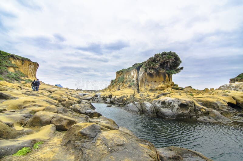
Peace Island belongs to Zhongzheng District, Keelung City, Taiwan. It is located at the north end of Keelung Harbor, on the east side of the port, about 4 kilometers from Keelung City. The island covers an area of more than 66 hectares and has now formed a land-connected island with Taiwan Island. Due to the impact of the northeast monsoon and wave erosion throughout the year, the natural landscape of Peace Island is peculiar. In addition, the coast of Peace Island belongs to a subsided coast, which has created many unique and bizarre rock formations. Because of the unique landscape, the government has planned to develop Peace Island into a coastal park. After being closed for three years and refurbished, it was renamed Peace Island Park and reopened in June 2012. The initial plan includes three main areas: a sea swimming pool, a rock formation area, and a tourist service center. In the later stage, camping and barbecue areas will also be opened to provide visitors with more choices for sightseeing.
圖片編號:
271981232
拍攝者:
Joyechen
點數下載
| 授權類型 | 尺寸 | 像素 | 格式 | 點數 | |
|---|---|---|---|---|---|
| 標準授權 | XS | 480 x 320 | JPG | 13 | |
| 標準授權 | S | 800 x 534 | JPG | 15 | |
| 標準授權 | M | 2120 x 1414 | JPG | 18 | |
| 標準授權 | L | 2737 x 1826 | JPG | 20 | |
| 標準授權 | XL | 3462 x 2310 | JPG | 22 | |
| 標準授權 | MAX | 6644 x 4434 | JPG | 23 | |
| 標準授權 | TIFF | 9396 x 6271 | TIF | 39 | |
| 進階授權 | WEL | 6644 x 4434 | JPG | 88 | |
| 進階授權 | PEL | 6644 x 4434 | JPG | 88 | |
| 進階授權 | UEL | 6644 x 4434 | JPG | 88 |
XS
S
M
L
XL
MAX
TIFF
WEL
PEL
UEL
| 標準授權 | 480 x 320 px | JPG | 13 點 |
| 標準授權 | 800 x 534 px | JPG | 15 點 |
| 標準授權 | 2120 x 1414 px | JPG | 18 點 |
| 標準授權 | 2737 x 1826 px | JPG | 20 點 |
| 標準授權 | 3462 x 2310 px | JPG | 22 點 |
| 標準授權 | 6644 x 4434 px | JPG | 23 點 |
| 標準授權 | 9396 x 6271 px | TIF | 39 點 |
| 進階授權 | 6644 x 4434 px | JPG | 88 點 |
| 進階授權 | 6644 x 4434 px | JPG | 88 點 |
| 進階授權 | 6644 x 4434 px | JPG | 88 點 |


 +886-2-8978-1616
 +886-2-2078-5115


