


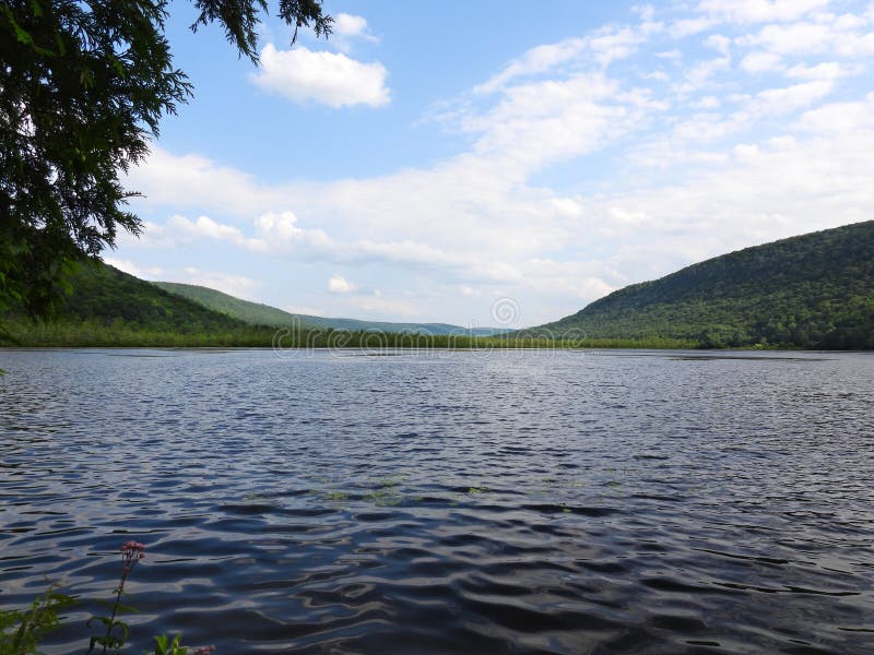
Labrador Pond is located on the borders of Onondaga and Cortland counties near the Village of Tully. Part of the Labrador Hollow Unique Area. The area is located in the middle of a valley running north to south that was dug out by glacial movement that occurred during the Pleistocene Epoch. Massive ice sheets from the last glaciation episode retreated from the area approximately ten thousand years ago. They left behind numerous sedimentary deposits and superficial features, some of which filled with water and are now called the Finger Lakes, while others became known as valleys. The floor of Labrador Hollow`s valley is only about one-half mile wide, but its walls rise abruptly for several hundred feet. The Labrador Hollow accessible boardwalk is nearly 2,000 feet in length and is a well-known attraction. Accessible to those with mobility impairments, the newly rebuilt boardwalk traverses a diverse wetland complex and provides a glimpse of flora and fauna that inhabit New York`s freshwater wetlands.
圖片編號:
284683547
拍攝者:
Mccrainemercantile
點數下載
| 授權類型 | 尺寸 | 像素 | 格式 | 點數 | |
|---|---|---|---|---|---|
| 標準授權 | XS | 480 x 360 | JPG | 13 | |
| 標準授權 | S | 800 x 600 | JPG | 15 | |
| 標準授權 | M | 2000 x 1500 | JPG | 18 | |
| 標準授權 | L | 2581 x 1936 | JPG | 20 | |
| 標準授權 | XL | 3265 x 2449 | JPG | 22 | |
| 標準授權 | MAX | 4608 x 3456 | JPG | 23 | |
| 標準授權 | TIFF | 6517 x 4888 | TIF | 39 | |
| 進階授權 | WEL | 4608 x 3456 | JPG | 88 | |
| 進階授權 | PEL | 4608 x 3456 | JPG | 88 | |
| 進階授權 | UEL | 4608 x 3456 | JPG | 88 |
XS
S
M
L
XL
MAX
TIFF
WEL
PEL
UEL
| 標準授權 | 480 x 360 px | JPG | 13 點 |
| 標準授權 | 800 x 600 px | JPG | 15 點 |
| 標準授權 | 2000 x 1500 px | JPG | 18 點 |
| 標準授權 | 2581 x 1936 px | JPG | 20 點 |
| 標準授權 | 3265 x 2449 px | JPG | 22 點 |
| 標準授權 | 4608 x 3456 px | JPG | 23 點 |
| 標準授權 | 6517 x 4888 px | TIF | 39 點 |
| 進階授權 | 4608 x 3456 px | JPG | 88 點 |
| 進階授權 | 4608 x 3456 px | JPG | 88 點 |
| 進階授權 | 4608 x 3456 px | JPG | 88 點 |


 +886-2-8978-1616
 +886-2-2078-5115


