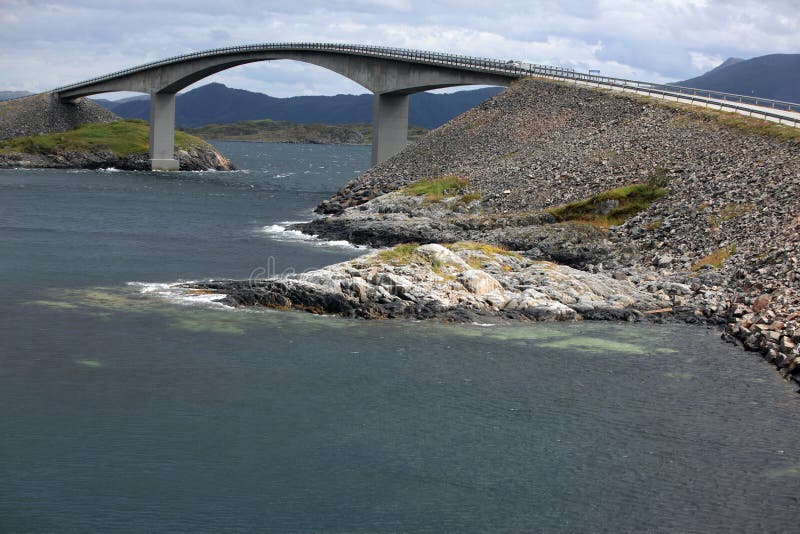
The Storseisundet Bridge (Norwegian: Storseisundbrua) is the longest of the eight bridges that make up the Atlanterhavsveien ("The Atlantic Road"), the road connection from the mainland Romsdal peninsula to the island of Averoya in More og Romsdal county, Norway.The bridge sits on the border between Hustadvika Municipality and Averoy Municipality and passes through an archipelago as it links mainland Norway with the island of Averoy. It is one of the country's official national tourist routes. Storseisundet Bridge is a cantilever bridge that is 260 metres long and with a maximum clearance to the sea of 23 metres. It was opened on 7 July 1989, and it was a toll road until June 1999. Over the six years that it took to construct, workers struggled with the region's wild weather and were interrupted by twelve hurricanes.
圖片編號:
289845057
拍攝者:
Rechitansorin
點數下載
| 授權類型 | 尺寸 | 像素 | 格式 | 點數 | |
|---|---|---|---|---|---|
| 標準授權 | XS | 480 x 320 | JPG | 13 | |
| 標準授權 | S | 800 x 534 | JPG | 15 | |
| 標準授權 | M | 2120 x 1414 | JPG | 18 | |
| 標準授權 | L | 2737 x 1826 | JPG | 20 | |
| 標準授權 | XL | 3463 x 2309 | JPG | 22 | |
| 標準授權 | MAX | 5000 x 3335 | JPG | 23 | |
| 標準授權 | TIFF | 7071 x 4716 | TIF | 39 | |
| 進階授權 | WEL | 5000 x 3335 | JPG | 88 | |
| 進階授權 | PEL | 5000 x 3335 | JPG | 88 | |
| 進階授權 | UEL | 5000 x 3335 | JPG | 88 |
XS
S
M
L
XL
MAX
TIFF
WEL
PEL
UEL
| 標準授權 | 480 x 320 px | JPG | 13 點 |
| 標準授權 | 800 x 534 px | JPG | 15 點 |
| 標準授權 | 2120 x 1414 px | JPG | 18 點 |
| 標準授權 | 2737 x 1826 px | JPG | 20 點 |
| 標準授權 | 3463 x 2309 px | JPG | 22 點 |
| 標準授權 | 5000 x 3335 px | JPG | 23 點 |
| 標準授權 | 7071 x 4716 px | TIF | 39 點 |
| 進階授權 | 5000 x 3335 px | JPG | 88 點 |
| 進階授權 | 5000 x 3335 px | JPG | 88 點 |
| 進階授權 | 5000 x 3335 px | JPG | 88 點 |


 +886-2-8978-1616
 +886-2-2078-5115


