


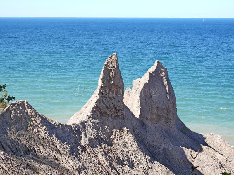
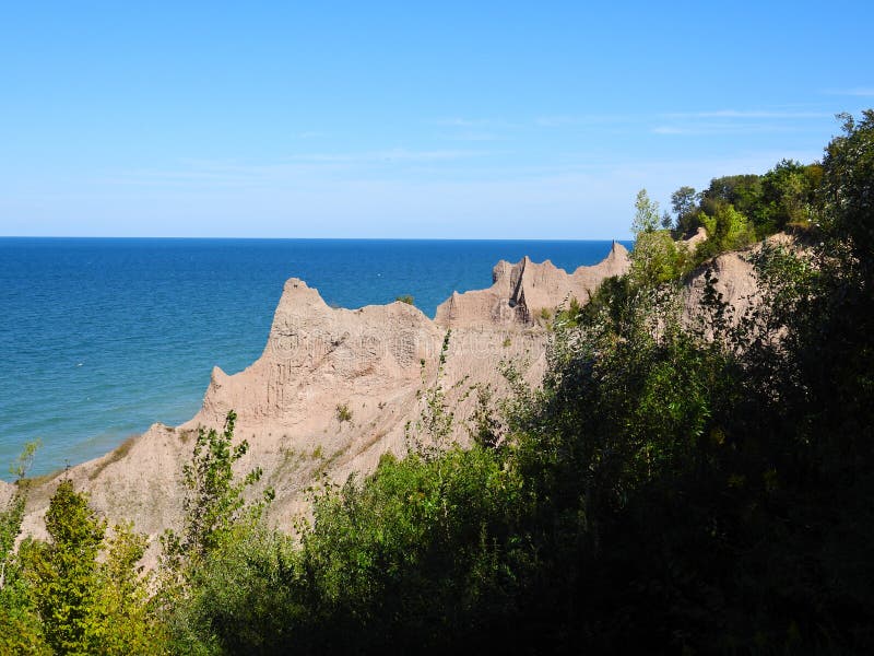
Landmark Chimney Bluffs State Park on southern Lake Ontario shore.
The red colored bluffs are formed from eroded drumlins, teardrop-shaped hills of glacial till that were deposited and shaped by glaciers during the most recent ice age. The erosive power of wind, rain, snow, and waves has formed the landscape into sharp pinnacles. Although the pinnacles and cliffs, some of which rise up to 150 feet above the lake shore, have existed for thousands of years, they are constantly changing and further eroding. Visitors can see Nine Mile Point Nuclear Generating Station, 25 miles to the northeast, as well as the giant coal smokestacks located in Oswego.
圖片編號:
291289176
拍攝者:
Mccrainemercantile
點數下載
| 授權類型 | 尺寸 | 像素 | 格式 | 點數 | |
|---|---|---|---|---|---|
| 標準授權 | XS | 358 x 480 | JPG | 13 | |
| 標準授權 | S | 596 x 800 | JPG | 15 | |
| 標準授權 | M | 1495 x 2006 | JPG | 18 | |
| 標準授權 | L | 1930 x 2589 | JPG | 20 | |
| 標準授權 | XL | 2441 x 3276 | JPG | 22 | |
| 標準授權 | MAX | 3282 x 4403 | JPG | 23 | |
| 標準授權 | TIFF | 4641 x 6227 | TIF | 39 | |
| 進階授權 | WEL | 3282 x 4403 | JPG | 88 | |
| 進階授權 | PEL | 3282 x 4403 | JPG | 88 | |
| 進階授權 | UEL | 3282 x 4403 | JPG | 88 |
XS
S
M
L
XL
MAX
TIFF
WEL
PEL
UEL
| 標準授權 | 358 x 480 px | JPG | 13 點 |
| 標準授權 | 596 x 800 px | JPG | 15 點 |
| 標準授權 | 1495 x 2006 px | JPG | 18 點 |
| 標準授權 | 1930 x 2589 px | JPG | 20 點 |
| 標準授權 | 2441 x 3276 px | JPG | 22 點 |
| 標準授權 | 3282 x 4403 px | JPG | 23 點 |
| 標準授權 | 4641 x 6227 px | TIF | 39 點 |
| 進階授權 | 3282 x 4403 px | JPG | 88 點 |
| 進階授權 | 3282 x 4403 px | JPG | 88 點 |
| 進階授權 | 3282 x 4403 px | JPG | 88 點 |


 +886-2-8978-1616
 +886-2-2078-5115


