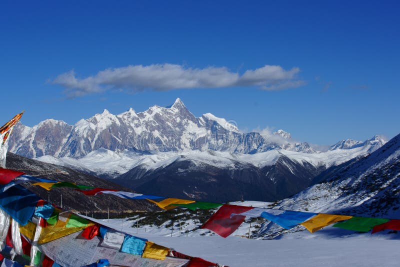
Namchabarwa is a mountain in the Tibetan Himalaya. The traditional definition of the Himalaya extending from the Indus River to the Brahmaputra would make it the eastern anchor of the entire mountain chain, and it is the highest peak of its own section as well Earth s easternmost peak over 7,600 metres.In the evening, the snow-capped mountains turn pink under the setting sun.Quiet little village nestled at the foot of snow-capped mountains.This landscape is located at the Sejila Pass on National Highway 318.National Highway 318 is a famous landscape avenue in China.Must go in your life.
圖片編號:
342893345
拍攝者:
Henrywei
點數下載
| 授權類型 | 尺寸 | 像素 | 格式 | 點數 | |
|---|---|---|---|---|---|
| 標準授權 | XS | 480 x 279 | JPG | 13 | |
| 標準授權 | S | 800 x 464 | JPG | 15 | |
| 標準授權 | M | 2273 x 1319 | JPG | 18 | |
| 標準授權 | L | 2934 x 1703 | JPG | 20 | |
| 標準授權 | XL | 4032 x 2341 | JPG | 22 | |
| 標準授權 | MAX | 4546 x 2639 | JPG | 23 | |
| 標準授權 | TIFF | 5702 x 3311 | TIF | 39 | |
| 進階授權 | WEL | 4546 x 2639 | JPG | 88 | |
| 進階授權 | PEL | 4546 x 2639 | JPG | 88 | |
| 進階授權 | UEL | 4546 x 2639 | JPG | 88 |
XS
S
M
L
XL
MAX
TIFF
WEL
PEL
UEL
| 標準授權 | 480 x 279 px | JPG | 13 點 |
| 標準授權 | 800 x 464 px | JPG | 15 點 |
| 標準授權 | 2273 x 1319 px | JPG | 18 點 |
| 標準授權 | 2934 x 1703 px | JPG | 20 點 |
| 標準授權 | 4032 x 2341 px | JPG | 22 點 |
| 標準授權 | 4546 x 2639 px | JPG | 23 點 |
| 標準授權 | 5702 x 3311 px | TIF | 39 點 |
| 進階授權 | 4546 x 2639 px | JPG | 88 點 |
| 進階授權 | 4546 x 2639 px | JPG | 88 點 |
| 進階授權 | 4546 x 2639 px | JPG | 88 點 |


 +886-2-8978-1616
 +886-2-2078-5115


