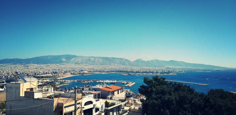
Athens sprawls across the central plain of Attica that is often referred to as the Athens or Attica Basin The basin is bounded by four large mountains: Mount Aegaleo to the west, Mount Parnitha to the north, Mount Penteli to the northeast and Mount Hymettus to the east. Beyond Mount Aegaleo lies the Thriasian plain, which forms an extension of the central plain to the west. The Saronic Gulf lies to the southwest. Mount Parnitha is the tallest of the four mountains and has been declared a national park. Athens is built around a number of hills. Lycabettus is one of the tallest hills of the city proper and provides a view of the entire Attica Basin.
圖片編號:
35783561
拍攝者:
Valery109
點數下載
| 授權類型 | 尺寸 | 像素 | 格式 | 點數 | |
|---|---|---|---|---|---|
| 標準授權 | XS | 480 x 320 | JPG | 13 | |
| 標準授權 | S | 800 x 533 | JPG | 15 | |
| 標準授權 | M | 2121 x 1414 | JPG | 18 | |
| 標準授權 | L | 2738 x 1825 | JPG | 20 | |
| 標準授權 | XL | 3464 x 2309 | JPG | 22 | |
| 標準授權 | MAX | 5472 x 3648 | JPG | 23 | |
| 標準授權 | TIFF | 7739 x 5159 | TIF | 39 | |
| 進階授權 | WEL | 5472 x 3648 | JPG | 88 | |
| 進階授權 | UEL | 5472 x 3648 | JPG | 88 |
XS
S
M
L
XL
MAX
TIFF
WEL
UEL
| 標準授權 | 480 x 320 px | JPG | 13 點 |
| 標準授權 | 800 x 533 px | JPG | 15 點 |
| 標準授權 | 2121 x 1414 px | JPG | 18 點 |
| 標準授權 | 2738 x 1825 px | JPG | 20 點 |
| 標準授權 | 3464 x 2309 px | JPG | 22 點 |
| 標準授權 | 5472 x 3648 px | JPG | 23 點 |
| 標準授權 | 7739 x 5159 px | TIF | 39 點 |
| 進階授權 | 5472 x 3648 px | JPG | 88 點 |
| 進階授權 | 5472 x 3648 px | JPG | 88 點 |


 +886-2-8978-1616
 +886-2-2078-5115


