


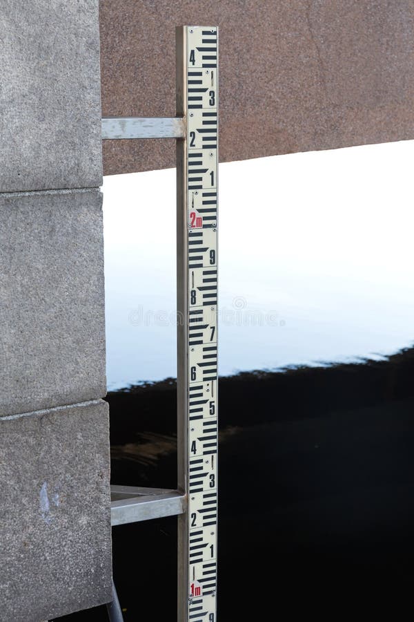
Measuring pole for measuring the tides, currents, wind speed and direction, temperature, pressure; placed after the last big storm, and very high water in 2008 in the Waddenzee. This sea is the largest unbroken system of intertidal sand and mud flats in the world. It is a large, temperate, relatively flat coastal wetland environment, formed by the intricate interactions between physical and biological factors that have given rise to a multitude of transitional habitats with tidal channels, sandy shoals, sea-grass meadows, mussel beds, sandbars, mudflats, salt marshes, estuaries, beaches and dunes.
圖片編號:
50416811
拍攝者:
2circles
點數下載
| 授權類型 | 尺寸 | 像素 | 格式 | 點數 | |
|---|---|---|---|---|---|
| 標準授權 | XS | 320 x 480 | JPG | 13 | |
| 標準授權 | S | 533 x 800 | JPG | 15 | |
| 標準授權 | M | 1414 x 2121 | JPG | 18 | |
| 標準授權 | L | 1825 x 2738 | JPG | 20 | |
| 標準授權 | XL | 2309 x 3464 | JPG | 22 | |
| 標準授權 | MAX | 3168 x 4752 | JPG | 23 | |
| 標準授權 | ADD | Vector | AI | 38 | |
| 標準授權 | TIFF | 4480 x 6720 | TIF | 39 | |
| 進階授權 | WEL | 3168 x 4752 | JPG | 88 | |
| 進階授權 | PEL | 3168 x 4752 | JPG | 88 | |
| 進階授權 | UEL | 3168 x 4752 | JPG | 88 |
XS
S
M
L
XL
MAX
ADD
TIFF
WEL
PEL
UEL
| 標準授權 | 320 x 480 px | JPG | 13 點 |
| 標準授權 | 533 x 800 px | JPG | 15 點 |
| 標準授權 | 1414 x 2121 px | JPG | 18 點 |
| 標準授權 | 1825 x 2738 px | JPG | 20 點 |
| 標準授權 | 2309 x 3464 px | JPG | 22 點 |
| 標準授權 | 3168 x 4752 px | JPG | 23 點 |
| 標準授權 | Vector px | AI | 38 點 |
| 標準授權 | 4480 x 6720 px | TIF | 39 點 |
| 進階授權 | 3168 x 4752 px | JPG | 88 點 |
| 進階授權 | 3168 x 4752 px | JPG | 88 點 |
| 進階授權 | 3168 x 4752 px | JPG | 88 點 |


 +886-2-8978-1616
 +886-2-2078-5115


