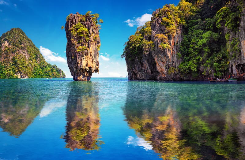
Phang Nga Bay is a 400 km2 bay in the Strait of Malacca between the island of Phuket and the mainland of the Malay peninsula of southern Thailand. Since 1981, an extensive section of the bay has been protected as the Ao Phang Nga National Park. The park is in Phang Nga Province, at 08ð17'N 098ð36'E. Limestone cliffs with caves, collapsed cave systems, and archaeological sites are found about Ph
圖片編號:
65178663
拍攝者:
Giamplume
點數下載
| 授權類型 | 尺寸 | 像素 | 格式 | 點數 | |
|---|---|---|---|---|---|
| 標準授權 | XS | 480 x 319 | JPG | 13 | |
| 標準授權 | S | 800 x 532 | JPG | 15 | |
| 標準授權 | M | 2123 x 1412 | JPG | 18 | |
| 標準授權 | L | 2741 x 1824 | JPG | 20 | |
| 標準授權 | XL | 3467 x 2307 | JPG | 22 | |
| 標準授權 | MAX | 4256 x 2832 | JPG | 23 | |
| 標準授權 | TIFF | 6019 x 4005 | TIF | 39 | |
| 進階授權 | WEL | 4256 x 2832 | JPG | 88 | |
| 進階授權 | PEL | 4256 x 2832 | JPG | 88 | |
| 進階授權 | UEL | 4256 x 2832 | JPG | 88 |
XS
S
M
L
XL
MAX
TIFF
WEL
PEL
UEL
| 標準授權 | 480 x 319 px | JPG | 13 點 |
| 標準授權 | 800 x 532 px | JPG | 15 點 |
| 標準授權 | 2123 x 1412 px | JPG | 18 點 |
| 標準授權 | 2741 x 1824 px | JPG | 20 點 |
| 標準授權 | 3467 x 2307 px | JPG | 22 點 |
| 標準授權 | 4256 x 2832 px | JPG | 23 點 |
| 標準授權 | 6019 x 4005 px | TIF | 39 點 |
| 進階授權 | 4256 x 2832 px | JPG | 88 點 |
| 進階授權 | 4256 x 2832 px | JPG | 88 點 |
| 進階授權 | 4256 x 2832 px | JPG | 88 點 |


 +886-2-8978-1616
 +886-2-2078-5115


