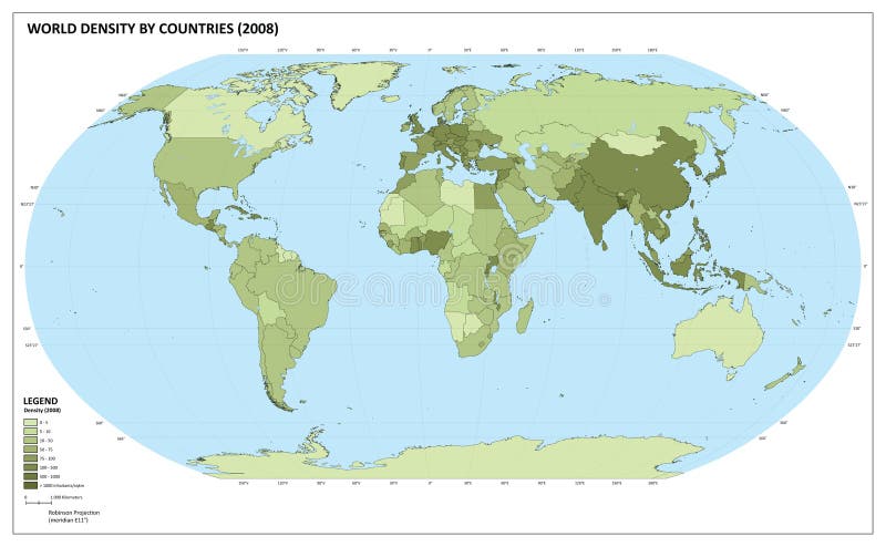
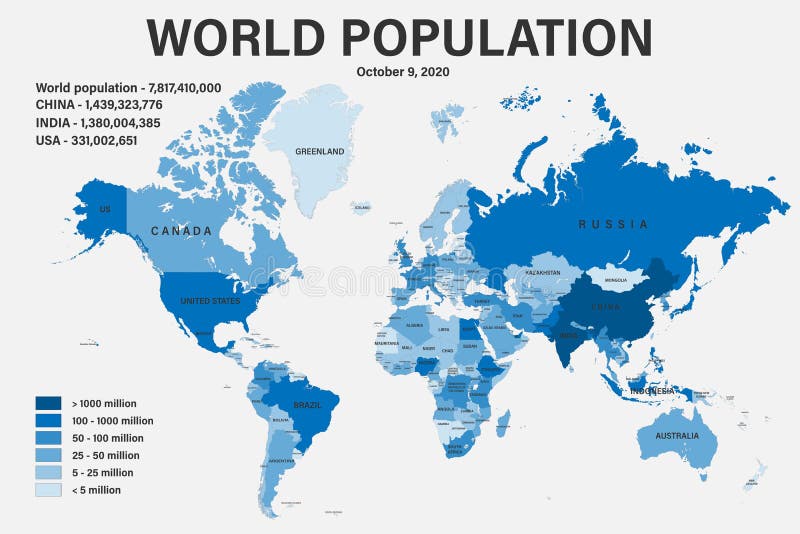
World map with population density number (inhabitants/square kilometers). The maps are in ial format (EPS), and contains almost 250 countries and territories (including Kosovo, Abkhazia and others with little international recognition). The maps have legend about the colour representation. Maps are made in Robinson World projection, with central meridian at E11. Population datas are from 2008 (official and UN estimation).
圖片編號:
6742086
拍攝者:
Emicristea
點數下載
| 授權類型 | 尺寸 | 像素 | 格式 | 點數 | |
|---|---|---|---|---|---|
| 標準授權 | XS | 480 x 296 | JPG | 13 | |
| 標準授權 | S | 800 x 493 | JPG | 15 | |
| 標準授權 | M | 2205 x 1360 | JPG | 18 | |
| 標準授權 | L | 2847 x 1755 | JPG | 20 | |
| 標準授權 | XL | 3601 x 2221 | JPG | 22 | |
| 標準授權 | MAX | 4724 x 2913 | JPG | 23 | |
| 標準授權 | ADD | Vector | AI | 38 | |
| 標準授權 | TIFF | 6681 x 4120 | TIF | 39 | |
| 進階授權 | WEL | 4724 x 2913 | JPG | 88 | |
| 進階授權 | PEL | 4724 x 2913 | JPG | 88 | |
| 進階授權 | UEL | 4724 x 2913 | JPG | 88 |
XS
S
M
L
XL
MAX
ADD
TIFF
WEL
PEL
UEL
| 標準授權 | 480 x 296 px | JPG | 13 點 |
| 標準授權 | 800 x 493 px | JPG | 15 點 |
| 標準授權 | 2205 x 1360 px | JPG | 18 點 |
| 標準授權 | 2847 x 1755 px | JPG | 20 點 |
| 標準授權 | 3601 x 2221 px | JPG | 22 點 |
| 標準授權 | 4724 x 2913 px | JPG | 23 點 |
| 標準授權 | Vector px | AI | 38 點 |
| 標準授權 | 6681 x 4120 px | TIF | 39 點 |
| 進階授權 | 4724 x 2913 px | JPG | 88 點 |
| 進階授權 | 4724 x 2913 px | JPG | 88 點 |
| 進階授權 | 4724 x 2913 px | JPG | 88 點 |







 +886-2-8978-1616
 +886-2-2078-5115


