


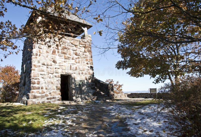
An old stone tower lookout area on top of Wayah Bald in North Carolina. It was used the the early 1900's and has the intersections of the Bartram Trail and the Appalachian Trail nearby. Wayah Bald has a vantage point 5,342 feet in elevation in the Nantahala National Forest, near Franklin, North Carolina. On a clear day, you can see north to the Great Smoky Mountains in Tennessee and south into the rolling hills of Georgia. It was listed on the National Historic Lookout Register in 2007
圖片編號:
拍攝者:
Noonie
點數下載
| 授權類型 | 尺寸 | 像素 | 格式 | 點數 | |
|---|---|---|---|---|---|
| 標準授權 | XS | 480 x 329 | JPG | 13 | |
| 標準授權 | S | 800 x 548 | JPG | 15 | |
| 標準授權 | M | 2093 x 1433 | JPG | 18 | |
| 標準授權 | L | 2702 x 1850 | JPG | 20 | |
| 標準授權 | XL | 3786 x 2592 | JPG | 22 | |
| 標準授權 | MAX | 4186 x 2866 | JPG | 23 | |
| 標準授權 | TIFF | 5354 x 3666 | TIF | 39 | |
| 進階授權 | WEL | 4186 x 2866 | JPG | 88 | |
| 進階授權 | PEL | 4186 x 2866 | JPG | 88 | |
| 進階授權 | UEL | 4186 x 2866 | JPG | 88 |
XS
S
M
L
XL
MAX
TIFF
WEL
PEL
UEL
| 標準授權 | 480 x 329 px | JPG | 13 點 |
| 標準授權 | 800 x 548 px | JPG | 15 點 |
| 標準授權 | 2093 x 1433 px | JPG | 18 點 |
| 標準授權 | 2702 x 1850 px | JPG | 20 點 |
| 標準授權 | 3786 x 2592 px | JPG | 22 點 |
| 標準授權 | 4186 x 2866 px | JPG | 23 點 |
| 標準授權 | 5354 x 3666 px | TIF | 39 點 |
| 進階授權 | 4186 x 2866 px | JPG | 88 點 |
| 進階授權 | 4186 x 2866 px | JPG | 88 點 |
| 進階授權 | 4186 x 2866 px | JPG | 88 點 |


 +886-2-8978-1616
 +886-2-2078-5115


