


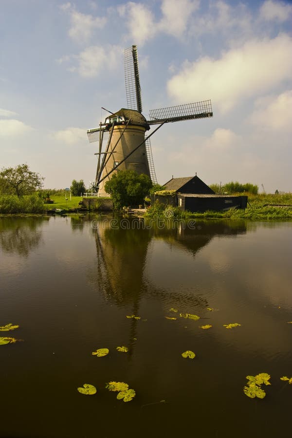
The nineteen windmills of Kinderdijk symbolise the way in which the Dutch have managed the water. For centuries, they have kept the land dry, which had been ravaged by subsidence and floods: the Alblasserwaard, once a rough and wet peat bog, but eventually colonised and reclaimed by man. Pastures with grazing cattle, pollard willows and windmills, elongated villages along dykes and rivers, historical farms and standard-tree orchards in full bloom: this is the typically agricultural landscape of ââ¬ËAlblasserwaard en Vijfheerenlandenââ¬â¢, the southern edge of the Groene Hart (Green Heart) of the Netherlands. The Kinderdijk windmill area is situated in the Alblasserwaard between the rivers Lek and Merwede, about 25 kilometres from Rotterdam. In 1997, UNESCO inscribed the windmill area on the World Heritage list, a recognition of its unique character.
圖片編號:
8662173
拍攝者:
Ronterburg
點數下載
| 授權類型 | 尺寸 | 像素 | 格式 | 點數 | |
|---|---|---|---|---|---|
| 標準授權 | XS | 320 x 480 | JPG | 13 | |
| 標準授權 | S | 533 x 800 | JPG | 15 | |
| 標準授權 | M | 1414 x 2121 | JPG | 18 | |
| 標準授權 | L | 2048 x 3072 | JPG | 20 | |
| 標準授權 | XL | 2309 x 3464 | JPG | 22 | |
| 標準授權 | MAX | 2828 x 4242 | JPG | 23 | |
| 標準授權 | TIFF | 2896 x 4344 | TIF | 39 | |
| 進階授權 | WEL | 2828 x 4242 | JPG | 88 | |
| 進階授權 | PEL | 2828 x 4242 | JPG | 88 | |
| 進階授權 | UEL | 2828 x 4242 | JPG | 88 |
XS
S
M
L
XL
MAX
TIFF
WEL
PEL
UEL
| 標準授權 | 320 x 480 px | JPG | 13 點 |
| 標準授權 | 533 x 800 px | JPG | 15 點 |
| 標準授權 | 1414 x 2121 px | JPG | 18 點 |
| 標準授權 | 2048 x 3072 px | JPG | 20 點 |
| 標準授權 | 2309 x 3464 px | JPG | 22 點 |
| 標準授權 | 2828 x 4242 px | JPG | 23 點 |
| 標準授權 | 2896 x 4344 px | TIF | 39 點 |
| 進階授權 | 2828 x 4242 px | JPG | 88 點 |
| 進階授權 | 2828 x 4242 px | JPG | 88 點 |
| 進階授權 | 2828 x 4242 px | JPG | 88 點 |


 +886-2-8978-1616
 +886-2-2078-5115


